Curves Magazin (December 26, 2023) – A epic road trip through the southern island of New Zealand celebrating the 60th birthday of the Porsche 911.
The South Island of New Zealand is renowned for its mountains, lakes and glaciers. The Southern Alps, home to 3,724m-high Aoraki Mt. Cook, run along the entire length of the island. In the southwest is Fiordland National Park, with steep-sided Milford Sound. In the north is Abel Tasman National Park, known for its trails and ocean kayaking. Queenstown is famed for adventure sports like bungee jumping and skiing.
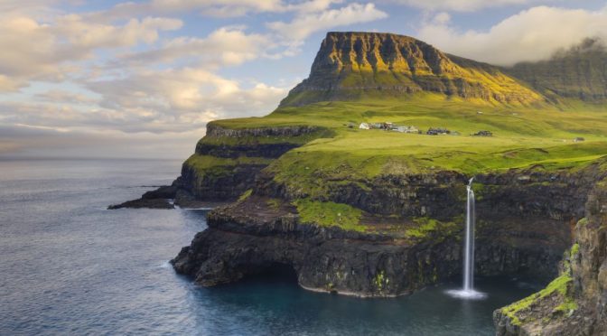
Lucas T. Jahn Films (October 27, 2023) – An exploration of 10 of the 18 Faroese Islands, from Viðoy in the north to Suðuroy in the far south. In total, more than 1000 km were driven during the 16 days.
The Faroe Islands is a self-governing archipelago, part of the Kingdom of Denmark. It comprises 18 rocky, volcanic islands between Iceland and Norway in the North Atlantic Ocean, connected by road tunnels, ferries, causeways and bridges. Hikers and bird-watchers are drawn to the islands’ mountains, valleys and grassy heathland, and steep coastal cliffs that harbor thousands of seabirds.
Lucas T. Jahn Films (April 29, 2023) – From sweeping sand dunes to desolate highways of emptiness, bustling cities, and snow-covered peaks, we explored Morocco from north to south and east to west. Driving more than 10,000 km in eight weeks, our roadtrip included many unforgettable adventures.
Watch as we explore remote landscapes, climb high peaks, battle breath-taking dust-topias (double pun, yeah!), and navigate the hectic bustle of Morocco’s major cities.
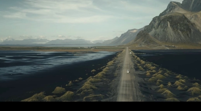
Uploaded April 12, 2023: The famous ‘Ring Road’ is a 1322 km (820 miles) loop connecting most towns and villages; a road trip renowned for its variety of scenery, passing many of Iceland’s most iconic sites.
The southern drive from Reykjavík to Egilsstaðir is the more scenic half, with waterfalls and glacial lagoons visible from the road. That is not to say this part of the country merits more of your time—only that there are more things to see and do along the Ring Road. Other regions reward a good detour, for instance along the Eastfjords or Snæfellsnes Peninsula. Travelers spending more than a week on the road should consider the scenic Arctic Coast Way and the Westfjords Way (Vestfjarðaleiðin).
“In September of last year, I had the opportunity to go on a father & son trip to Iceland, and I hope this video encourages you to do the same!”
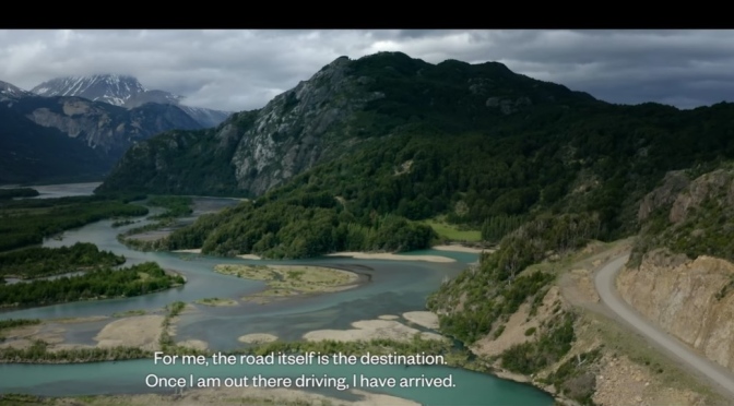
Curves Magazin (March 20, 2023) – An epic road trip through Patagonia in Southern Argentina.
Patagonia, semiarid scrub plateau that covers nearly all of the southern portion of mainland Argentina. With an area of about 260,000 square miles (673,000 square kilometres), it constitutes a vast area of steppe and desert that extends south from latitude 37° to 51° S.
It is bounded, approximately, by the Patagonian Andes to the west, the Colorado River to the north (except where the region extends north of the river into the Andean borderlands), the Atlantic Ocean to the east, and the Strait of Magellan to the south; the region south of the strait—Tierra del Fuego, which is divided between Argentina and Chile—also is often included in Patagonia.
Desert and semidesert cover the Patagonian tableland that extends from the Andes to the Atlantic Ocean. The general aspect of this tableland is one of vast steppelike (i.e., virtually treeless) plains, rising in terrace fashion from high coastal cliffs to the foot of the Andes; but the true aspect of the plains is by no means as simple as such a general description would imply. The land along the Negro River rises in a series of fairly level terraces from about 300 feet (90 metres) at the coast to about 1,300 feet at the junction of the Limay and Neuquén rivers and 3,000 feet at the base of the Andes. The tableland region rises to an altitude of 5,000 feet.
South of the Negro River, the plains are much more irregular. Volcanic eruptions occurred in this area until fairly recent times, and basaltic sheets covered the tableland east of Lakes Buenos Aires and Pueyrredón. Near the Chico and Santa Cruz rivers, the plains have spread to within about 50 miles (80 kilometres) of the coast and reach almost to the coast south of the Coig and Gallegos rivers. In places, basaltic massifs (mountain masses) are the salient features of the landscape.
Six days deep into the heart of the Sahara (in October-November 2022), into one of the most picturesque parts of the desert: Tassili n’Ajjer National Park of Algeria, near the borders with Libya and Niger.
Located in a strange lunar landscape of great geological interest, this site has one of the most important groupings of prehistoric cave art in the world. More than 15,000 drawings and engravings record the climatic changes, the animal migrations and the evolution of human life on the edge of the Sahara from 6000 BC to the first centuries of the present era. The geological formations are of outstanding scenic interest, with eroded sandstones forming ‘forests of rock’.
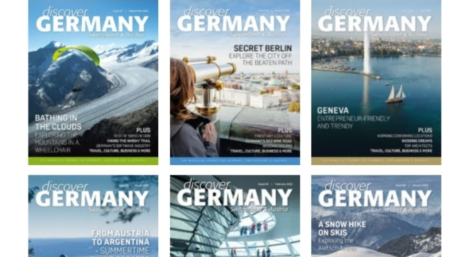
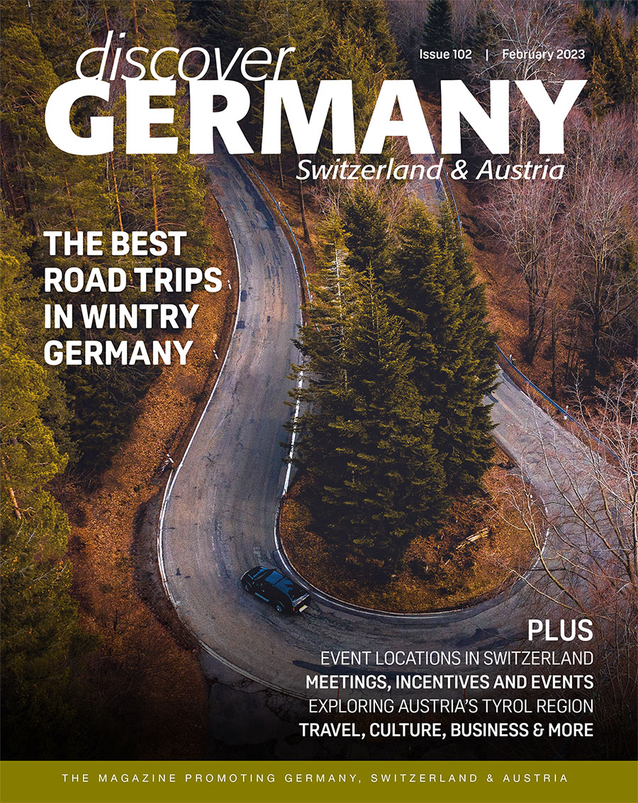
The February issue of Discover Germany, Austria & Switzerland introduces some great road trips for the wintery season, explores Austria’s Tyrol region and celebrates Germany’s fifth season, the carnival season.
It further covers an interview with coach and author MIMI, top event locations in Switzerland, a round-up of the companies behind some of the best meeting, and events, innovative companies, as well as some gorgeous hotels, top design items, and much more.
Curves Magazin – A roadtrip through northern and southern Malaysia starting in Kuala Lumpur.
Kuala Lumpur, capital of Malaysia. The city is located in west-central Peninsular (West) Malaysia, midway along the west coast tin and rubber belt and about 25 miles (40 km) east of its ocean port, Port Kelang, on the Strait of Malacca. It is the country’s largest urban area and its cultural, commercial, and transportation centre. In 1972 Kuala Lumpur was designated a municipality, and in 1974 this entity and adjacent portions of surrounding Selangor state became a federal territory.
Kuala Lumpur lies in hilly country astride the confluence of the Kelang and Gombak rivers; its name in Malay means “muddy estuary.” Malaysia’s Main Range rises nearby to the north, east, and southeast. The climate is equatorial, with high temperatures and humidity that vary little throughout the year. The area receives about 95 inches (2,400 mm) of rain annually; June and July are the driest months. Area federal territory, 94 square miles (243 square km). Pop. (2009 est.) city, 1,493,000; (2020) federal territory, 1,982,112.
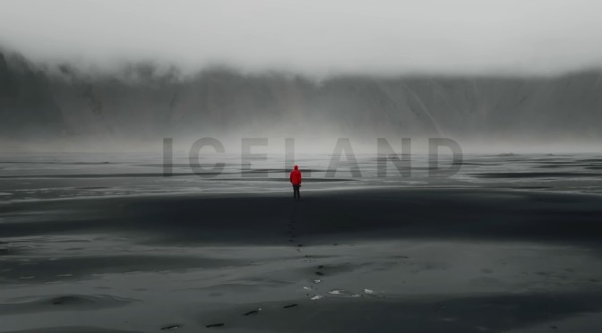
Denis Barbas – ICELAND – A trip of a lifetime. We spent 10 days on a road trip across this beautiful and unique country, sleeping in a rooftop tent, exploring the land of ice and fire and just having fun and enjoying our time on this trip, a trip that turned out to be our favorite ever, I hope you can see why in this video.


 Curves Magazin (March 20, 2023) – An epic road trip through Patagonia in Southern Argentina.