Tag Archives: Colorado River

Climate Documentary: ‘Colorado River In Crisis’

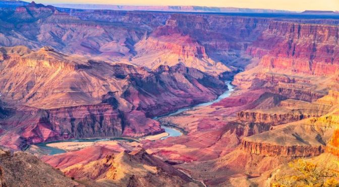
Los Angeles Times (November 15, 2023) – A team of Los Angeles Times journalists travels along the Colorado River to examine how the Southwest is grappling with the water crisis. The Colorado River can no longer withstand the thirst of the arid West.

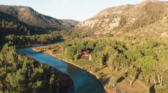
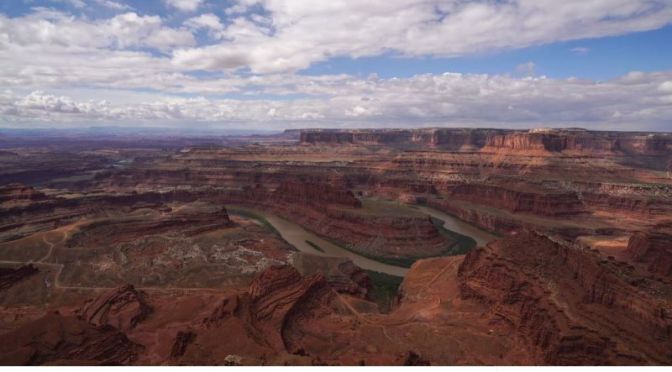
Water drawn from the river flows to millions of people in cities from Denver to Los Angeles and irrigates vast farmlands. For decades, sections of the river have been entirely used up, leaving dusty expanses of desert where water once flowed to the sea in Mexico. Now, chronic overuse and the effects of climate change are pushing the river system toward potential collapse, with depleted reservoirs near the lowest levels since they were filled.

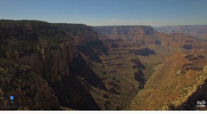
A water reckoning is about to transform the landscape of the Southwest. Colorado River in Crisis follows Los Angeles Times journalists traveling throughout the river’s watershed, from the headwaters in the Rocky Mountains to the river’s dry delta. These stories reveal the stark toll of the river’s decline, responses that have yet to match the scale of the crisis, and voices that are urging a fundamental rethinking of how water is managed and used to adapt to the reality of an overtapped and dwindling river.

This documentary was filmed and produced by Albert Brave Tiger Lee, with reporting by Ian James and other L.A. Times journalists. Consulting producers included Maggie Beidelman, Robert Meeks and Erik Himmelsbach-Weinstein. (46 minutes)

Read the L.A. Times series Colorado River in Crisis: https://www.latimes.com/environment/s…

Environment: The Grand Canyon Is Losing Its River

Long shadows are in the foreground of a view of the reddish canyon walls, which loom on either side and ahead. The sky is blue with ribbed white clouds.

The New York Times (June 6, 2023) – Down beneath the tourist lodges and shops selling keychains and incense, past windswept arroyos and brown valleys speckled with agave, juniper and sagebrush, the rocks of the Grand Canyon seem untethered from time. The oldest ones date back 1.8 billion years, not just eons before humans laid eyes on them, but eons before evolution endowed any organism on this planet with eyes.

The Grand Canyon, a Cathedral to Time, Is Losing Its River

Written and photographed by Raymond Zhong, who joined scientists on a 90-mile raft expedition through the canyon.

About half a dozen people with orange life jackets ride a blue raft on a murky, brownish and somewhat choppy Colorado River. Rust-colored canyon walls loom on either side and ahead of them. Three other rafts are in the distance.

Since 1963, the Glen Canyon Dam has been backing up the Colorado for nearly 200 miles, in the form of America’s second-largest reservoir, Lake Powell. Engineers constantly evaluate water and electricity needs to decide how much of the river to let through the dam’s works and out the other end, first into the Grand Canyon, then into Lake Mead and, eventually, into fields and homes in Arizona, California, Nevada and Mexico.


Spend long enough in the canyon, and you might start feeling a little unmoored from time yourself.

A spring that looks like a narrow waterfall cascades out of a hole in a canyon wall down into a calm part of the Colorado River. The canyon walls are rust-red.
North Canyon, and a spring at Vasey’s Paradise.

The immense walls form a kind of cocoon, sealing you off from the modern world, with its cell signal and light pollution and disappointments. They draw your eyes relentlessly upward, as in a cathedral.

You might think you are seeing all the way to the top. But up and above are more walls, and above them even more, out of sight except for the occasional glimpse. For the canyon is not just deep. It is broad, too — 18 miles, rim to rim, at its widest. This is no mere cathedral of stone. It is a kingdom: sprawling, self-contained, an alternate reality existing magnificently outside of our own.

And yet, the Grand Canyon remains yoked to the present in one key respect. The Colorado River, whose wild energy incised the canyon over millions of years, is in crisis.

Read more

Drought: Las Vegas’ Model For Water Conservation

Bloomberg Originals (March 1, 2023) – In Nevada, Kal Penn investigates the lasting impacts of the Colorado River Compact, the 1922 agreement that doles out water rights to seven states. The system, over-optimistic from the start, is on the verge of collapse as water levels in key reservoirs approach dead pool-status. But in nearby Las Vegas, Kal explores strategies that have led that city to become one of the most successful in the US when it comes to water conservation.

Research: New Scientist Magazine – Nov 26, 2022

New Scientist Default Image

New Scientist – November 26, 2022:

COVER STORIES

  • FEATURES – The hunt for the lost ancestral language of Europe and southern Asia
  • FEATURES – Why the Colorado river is drying up – and what we can do about it
  • FEATURES – Will artificial intelligence ever discover new laws of physics?
  • NEWS – Drug that delays onset of type 1 diabetes gets approval in US

Drought: How Las Vegas Conserves So Much Water

As severe drought in the West forces states to make drastic water cuts, Las Vegas offers a road map to making the most out of every drop of water. Since 2002, Southern Nevada has cut its Colorado River water use by 26% while its population has grown by 750,000.

Droughts: The ‘Shrinking’ Of The Colorado River

August 2022 Cover
  • “Tier Drops,” by Lisa Owens Viani.
    Regulations and apportioning that were set up 100 years ago are under pressure as the Colorado River shrinks. As climate change accelerates and record-breaking drought worsens, cities, tribes, and industries must prepare for a future with less water. (Online  August 10)

The Coming Crisis Along the Colorado River

It’s past time to get real about the Southwest’s hardest-working river.

About 40 million people rely on the Colorado River as it flows from Wyoming to Mexico. But overuse and climate change have contributed to its reservoirs drying up at such a rapid rate that the probability of disastrous disruptions to the deliveries of water and hydroelectric power across the Southwest have become increasingly likely. Now the seven states that depend on the river must negotiate major cuts in water use by mid-August or have them imposed by the federal government.

Those cuts are merely the beginning as the region struggles to adapt to an increasingly arid West. The rules for operating the river’s shrinking reservoirs expire in 2026, and those seven states must forge a new agreement on water use for farmers, businesses and cities.

Read more at The New York Times

Top HIkes: ‘Devil’s Garden Trail’ – Arches National Park In Utah (4K Video)

Devils Garden Trail at Arches National Park is considered by many fans to be their favorite trail in the Park. View 7 Arches in this 7.8 mile heavily trafficked loop trail. The Park rates the trail as difficult.

Arches National Park lies north of Moab in the state of Utah. Bordered by the Colorado River in the southeast, it’s known as the site of more than 2,000 natural sandstone arches, such as the massive, red-hued Delicate Arch in the east. Long, thin Landscape Arch stands in Devils Garden to the north. Other geological formations include Balanced Rock, towering over the desert landscape in the middle of the park.

Aerial Travel: The ‘Grand Canyon – Arizona’ (Video)

The Grand Canyon  is a steep-sided canyon carved by the Colorado River in ArizonaUnited States. The Grand Canyon is 277 miles (446 km) long, up to 18 miles (29 km) wide and attains a depth of over a mile (6,093 feet or 1,857 meters).

The canyon and adjacent rim are contained within Grand Canyon National Park, the Kaibab National ForestGrand Canyon–Parashant National Monument, the Hualapai Indian Reservation, the Havasupai Indian Reservation and the Navajo Nation. President Theodore Roosevelt was a major proponent of preservation of the Grand Canyon area and visited it on numerous occasions to hunt and enjoy the scenery.

Travel Video: Hiking The 25-Mile ‘Tonto Trail’ Of The Grand Canyon, Arizona

Spent two days backpacking on the Hermit’s Rest Viewpoint to Tonto Trail to Bright Angel Trailhead in the Grand Canyon.

The dynamic interplay of soft and hard layers of stone created an open benchland at the rim of the Inner Gorge called the Tonto Platform. Easily visible from several South Rim overlooks, the greenish Tonto rocks have eroded into an obvious exception to the striking vertical cliffs that characterize most of Grand Canyon.

The Tonto Trail follows this natural trans-canyon route for 95 rough, unmaintained miles, from Red Canyon on the east to Garnet
Canyon on the west. All of this makes the Tonto Trail unique among Grand Canyon pathways. Most descend from the rim towards the Colorado River, but the Tonto Trail offers passage by foot up and down the canyon, parallel to the course of the river. Because of its length, most hikers approach the Tonto Trail not as a single unit, but rather as a series of installments, breaking the route down into four or five sections defined by rim-to-river trails and the natural lay of the land.

A notable lack of reliable water makes most of the Tonto Trail a daunting, possibly dangerous, proposition, but the section between Bright Angel Trail and the Hermit Trail is blessed with three water sources hikers can count on. As a result, this segment of the Tonto Trail offers a degree of civility not found elsewhere along the trail, and it is here that most hikers get their first exposure to the unique nature of this singular trans-canyon route.

New Travel Videos: ‘Cañon Lands’ In Moab, Utah (2020)

Filmed and Edited by: Jem Moore

Footage from two trips to the Moab, UT area, I’ve always been fascinated by the shadows of clouds on the landscape in a time lapse. Music is from “Bonne Bay Suite” by Jem Moore on solo hammer dulcimer. 

Moab is a city in eastern Utah. It’s a gateway to massive red rock formations in Arches National Park. Southwest, Canyonlands National Park features mesas and buttes carved by the Green and Colorado rivers, plus Native American rock art. Dinosaur tracks can be found at sites like Bull Canyon Overlook and Copper Ridge. In the city, collections at the Museum of Moab include dinosaur bones and archaeological artifacts.