

The Caucasus Mountains are a mountain system at the intersection of Europe and Asia. Stretching between the Black Sea and the Caspian Sea, it is surrounded by the Caucasus region and is home to Mount Elbrus, the highest peak in Europe at 5,642 metres above sea level.
Tag Archives: Aerial Views
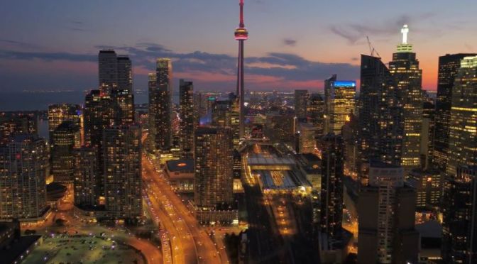
Skylines & Architecture: ‘Toronto, Canada’ (4K UHD)
Toronto, the capital of the province of Ontario, is a major Canadian city along Lake Ontario’s northwestern shore. It’s a dynamic metropolis with a core of soaring skyscrapers, all dwarfed by the iconic, free-standing CN Tower. Toronto also has many green spaces, from the orderly oval of Queen’s Park to 400-acre High Park and its trails, sports facilities and zoo.
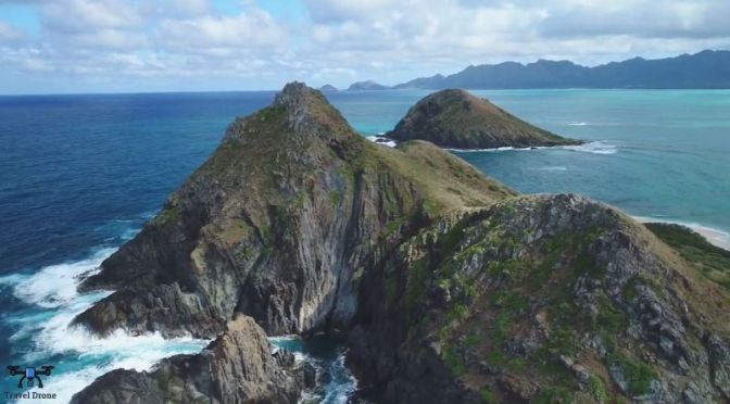
Aerial Views: ‘Coastline Of Oahu, Hawaii’ (4K Video)
Oahu is a U.S. island in the Central Pacific, part of the Hawaiian island chain and home to the state capital, Honolulu. Highlights of the city include historic Chinatown and the Punchbowl, a crater-turned-cemetery. Waikiki is an iconic beach, dining and nightlife area. West of Honolulu is Pearl Harbor, site of the WWII’s 1941 bombing attack and home to the USS Arizona Memorial.
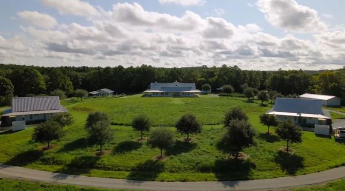
Views: ‘Whitehall Ranch’ Near Houston, Texas
The rolling hills and quiet pastoral setting of Whitehall, Texas have a wonderful secret – the 656± acre Whitehall Ranch, a master-planned ranch property with architectural consistency throughout every improvement within commuting distance to Houston or College Station.
Despite a very private and pristine setting, the ranch is easily accessed via Highway 6 and the new Highway 249 extension. Anchored by a private, family compound tucked into a natural protected setting, Whitehall Ranch reflects the thoughtful merger of inspiration and architecture. The main residence, two guest homes, and pool complex are a masterpiece of design and modern luxury with soaring ceilings and wall-to-wall windows.
No mechanical or aesthetic detail was overlooked. Terraced landscaping and manicured grasses offer a Zen-like setting among architectural symmetry and dramatic lines. The ranch is an incredible place to take pleasure in a multitude of year-round activities and to relax in luxury and savor the amazing scenery. The owner was in no rush to get this right and went to, and continues to go to, extraordinary lengths to ensure this ranch’s place among Texas’s finest properties.

Aerial Views: ‘Louisville – Kentucky’ (4K Video)
Louisville, Kentucky’s largest city, sits on the Ohio River along the Indiana border. Every May, its race course Churchill Downs hosts the Kentucky Derby, a renowned horse race whose long history is explored at the Kentucky Derby Museum. Baseball is celebrated at the Louisville Slugger Museum and Factory, where Major League bats are produced and a giant baseball “slugger” marks the entrance.
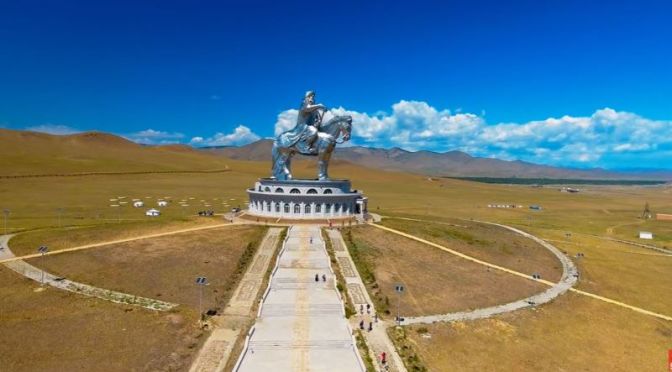
Aerial Views: ‘Cities And Landscapes Of Mongolia’
Mongolia, a nation bordered by China and Russia, is known for vast, rugged expanses and nomadic culture. Its capital, Ulaanbaatar, centers around Chinggis Khaan (Genghis Khan) Square, named for the notorious founder of the 13th- and 14th-century Mongol Empire. Also in Ulaanbaatar are the National Museum of Mongolia, displaying historic and ethnographic artifacts, and the restored 1830 Gandantegchinlen Monastery.

City Views: ‘Taipei, Taiwan’
Taipei, the capital of Taiwan, is a modern metropolis with Japanese colonial lanes, busy shopping streets and contemporary buildings. The skyline is crowned by the 509m-tall, bamboo-shaped Taipei 101 skyscraper, with upscale shops at the base and a rapid elevator to an observatory near the top. Taipei is also known for its lively street-food scene and many night markets, including expansive Shilin market.
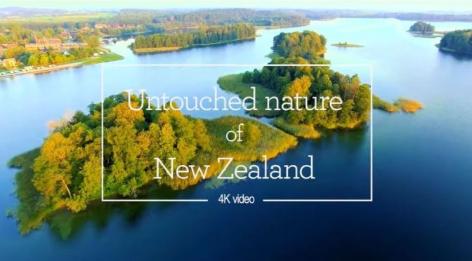
Aerial Views: Untouched Nature Of New Zealand
New Zealand is an island country in the southwestern Pacific Ocean. It consists of two main landmasses—the North Island and the South Island —and more than 700 smaller islands, covering a total area of 268,021 square kilometres.
Video timeline: 00:57 – Purakaunui Bay 02:26 – Mount Taranaki 04:21 – Mount Cook 05:41 – Roaring Billy Falls 07:44 – Omarama Clay Cliffs 11:06 – Lake Pukaki 12:26 – Lion Rock and Piha Beach 15:49 – Arthur’s Pass 17:40 – Castlepoint Lighthouse 21:21 – Lake Hawea 23:30 – Skippers Road 26:26 – Glacial valley in Southern Alps 27:52 – Kaikoura Seal Colony 29:04 – Ninety Mile Beach 31:16 – Whakarewarewa geothermal area 36:38 – Queenstown 38:37 – Whangarei Falls

Aerial Views: ‘Boston – Massachusetts’ (4K video)
Boston is the capital and most populous city of the Commonwealth of Massachusetts in the United States and 21st most populous city in the United States. The city proper covers 48.4 square miles with an estimated population of 692,600 in 2019, also making it the most populous city in New England.

Views From Above: ‘The Cotswolds – England’
The Cotswolds is a rural area of south central England covering parts of 6 counties, notably Gloucestershire and Oxfordshire. Its rolling hills and grassland harbour thatched medieval villages, churches and stately homes built of distinctive local yellow limestone. The 102-mile Cotswold Way walking trail follows the Cotswold Edge escarpment from Bath in the south to Chipping Campden in the north.
