CBS Sunday Morning (October 13, 2024): We leave you this Sunday morning along the Yellowstone River at Yellowstone National Park in Wyoming.
The Yellowstone River is the last major undammed river in the lower 48 states, flowing 671 miles (1080 km) from its source southeast of Yellowstone into the Missouri River and then, eventually, into the Atlantic Ocean. It begins in the Absaroka Mountain Range on Yount Peak. The river enters the park and meanders through the Thorofare region into Yellowstone Lake. It leaves the lake at Fishing Bridge and flows north over LeHardys Rapids and through Hayden Valley.
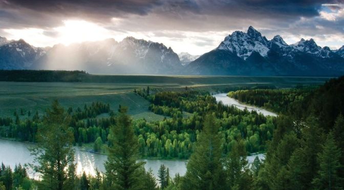
National Geographic (September 30, 2024): Nearly 4 million visitors per year are drawn by the soaring peaks, lush meadows and endless forests. However, often hidden from view, a hardy cast of animals, from tiny pikas to grizzly bears, tough it out to survive in this iconic, wild wonder of the West.
Explore this 300,000 acre patchwork of protected lands and the fascinating hidden lives of those that call Grand Teton National Park home.
CBS Sunday Morning (February 19, 2023): We leave you this Sunday morning at Devil’s Tower in Wyoming, our first National Monument, so designated by President Theodore Roosevelt in 1906. Videographer: Kevin Kjergaard.
Devils Tower is a butte, possibly laccolithic, composed of igneous rock in the Bear Lodge Ranger District of the Black Hills, near Hulett and Sundance in Crook County, northeastern Wyoming, above the Belle Fourche River. It rises 1,267 feet above the Belle Fourche River, standing 867 feet from summit to base.
This is a 13 mile hike in the Old Faithful area. I started at the Old Faithful parking lot, and did a clockwise loop around to Mallard Lake and back down to Old Faithful. After the thermal section, most of the hike is through thick forest. I was happy to see fresh bear tracks on the trail. This hike has a very good trail all the way and was an easy hike.
Old Faithful is a cone geyser in Yellowstone National Park in Wyoming, United States. It was named in 1870 during the Washburn–Langford–Doane Expedition and was the first geyser in the park to be named. It is a highly predictable geothermal feature and has erupted every 44 minutes to two hours since 2000.
Arguably the finest mountain ranch retreat in the Rocky Mountain West. Diamond G doesn’t just claim to have it all. It, in fact, does! Privacy – It lies at the end of the road, virtually surrounded by state and federal lands. Access – It is accessible year-round and lies about 17 miles from Dubois and about one hour and 15 minutes from the Jackson Hole Airport.
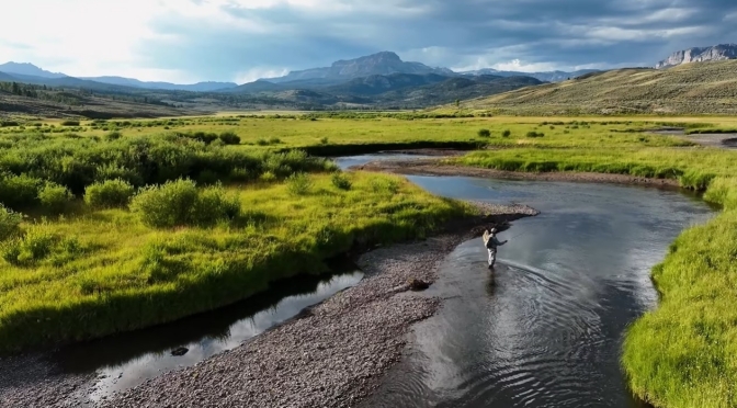
Fishing – It has an estimated 5 miles of the Dunoir River on private land with immediate access to 2.5 more miles on public land that is rarely accessed by the public. The Dunoir is a world-class trout fishery with trout in the 20 plus inch category. Wildlife – Bear, elk, moose, antelope, mountain lion, coyote, wolverine, multiple bird species, and both bighorn sheep and mountain goats are often seen in the adjacent national forest. It is one of the richest, wildest places for wildlife we have ever seen.
Scenery – Absolutely breathtaking with a lush riparian corridor flanked by timbered and open mountains rising to over 11,000 feet topped by dramatic rock formations and three major peaks – Ramshorn, Coffin Butte and Pinnacles. Improvements – Comfortable lodge and guest quarters, operating facilities, and staff quarters all in an authentic western vernacular.
Containing over 5,000 deeded acres – This is not just a small inholding in the national forest. When you come up the private road and see the ranch laid out before you, it is the real deal. There is virtually nothing else that one would want to own.
Bill Whitaker saddles up for one of the last enduring symbols of the Old West, a Wyoming cattle drive that travels the same route pioneered 125 years ago.
Upper Green River Valley, Wyoming
Predating most federal land management agencies, the Green River Drift cattle trail has been continuously used since the 1890s by the Upper Green River Cattle Association ranchers to get cattle from spring pasture on the desert to summer pasture in the forest. Chilly fall weather causes the cattle to “drift” back out of the forest to return to their home ranches. The trail, 58 miles long with 41 miles of spurs, crosses BLM, State of Wyoming, National Forest, and private properties. It has played a pivotal role in the development of ranching in the area as well as in the development of relationships between Federal agencies that manage grazing allotments and private property owners. The Drift was listed on the National Register in November, 2013. Because it is still being used much as it has for more than 100 years, the Drift was listed as a Traditional Cultural Property (TCP), the first ranching related TCP in the nation.
Wyoming is a state in the Mountain West subregion of the Western United States. The 10th largest state by area, it is also the least populous and least densely populated state in the contiguous United States. Wikipedia
Wyoming is a state in the Mountain West subregion of the Western United States. The 10th largest state by area, it is also the least populous and least densely populated state in the contiguous United States.
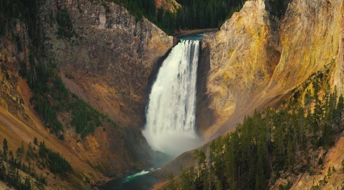
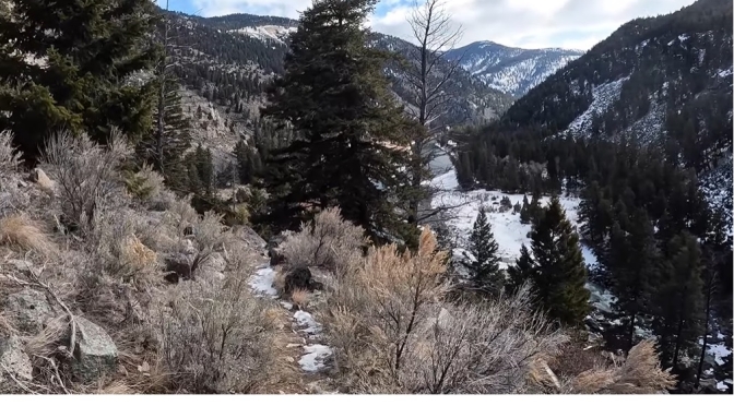
The Black Canyon of the Yellowstone covers an extensive stretch of the Yellowstone River near the northern border of Yellowstone National Park. This is a hiking and backpacking canyon, not a canyoneering destination. It’s characterized by spectacular scenery along the Yellowstone River, with interesting geology at the upstream sections.
News, Views and Reviews For The Intellectually Curious