
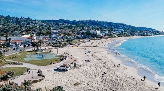
Laguna Beach is a small coastal city in Orange County, California. It’s known for its many art galleries, coves and beaches. Main Beach features tide pools and a boardwalk leading to the paths and gardens of nearby Heisler Park. Aliso Beach Park is a popular surf spot. The waters off Crystal Cove State Park are designated as an underwater park. Trails meander through coastal canyons in Laguna Coast Wilderness Park.
Tag Archives: Western United States
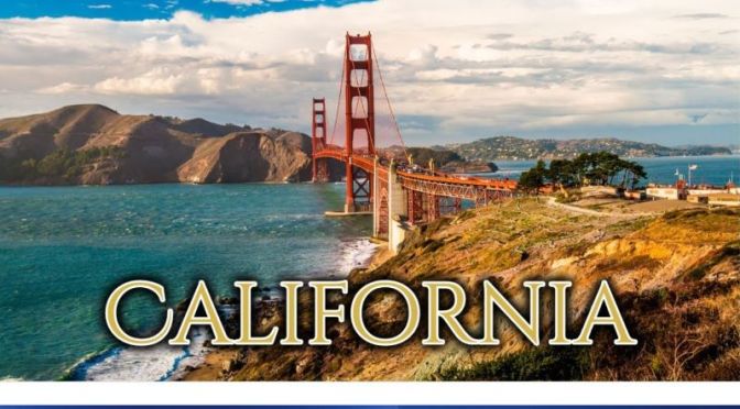
Travel In The Western U.S.: ‘California’ (4K Video)
California, a western U.S. state, stretches from the Mexican border along the Pacific for nearly 900 miles. Its terrain includes cliff-lined beaches, redwood forest, the Sierra Nevada Mountains, Central Valley farmland and the Mojave Desert. The city of Los Angeles is the seat of the Hollywood entertainment industry. Hilly San Francisco is known for the Golden Gate Bridge, Alcatraz Island and cable cars.

Hiking: ‘Grand Staircase-Escalante National Monument’, Utah (Video)
Join us at Utah’s Toadstool Hoodoos located in the beautiful Grand Staircase-Escalante National Monument. We’ll take you along with us for a short hike and then show you the toadstool hoodoos. I was able do get some sweet drone shots too (permitted). Hope you enjoy the video! Late June, 2020.
The Grand Staircase–Escalante National Monument is a United States national monument originally designated in 1996 as 1,880,461 acres of protected land in southern Utah. In 2017, the monument’s size was reduced by half in a succeeding presidential proclamation.
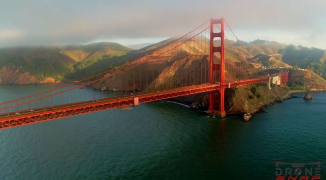
Views: The ‘Golden Gate Bridge’ In San Francisco, California (Video)
The Golden Gate Bridge stands at the entrance to California’s San Francisco Bay as a symbol of American ingenuity and resolve, having been constructed during the era of the Great Depression. Today, this beloved international icon and true engineering marvel carries about 40 million vehicles a year and serves not only as a vital transportation link but also as a major travel destination for millions of visitors from around the world.
Construction began on January 5, 1933. This was followed by the official ground breaking ceremony held on February 26, 1933, at nearby Crissy Field (now part of the Golden Gate National Recreation Area). The start of construction was met with great delight. A celebration at nearby Crissy Field went on for hours with at least 100,000 people in attendance. The San Francisco newspaper wrote the next day, “Two hundred and fifty carrier pigeons, provided by the San Francisco Racing Pigeon Club to carry the message of groundbreaking to every corner of California, were so frightened by the surging human mass that small boys had to crawl into their compartments in the bridge replica to shoo them out with sticks.”
Construction Timeline
December 22, 1932: Extending from Fort Baker pier, the construction of a 1,700 foot-long access road began to access the construction sites for the Marin anchorage, pier and tower.
January 5, 1933: Construction officially started.
January 1933 to February 1936: Marin and San Francisco anchorages and associated pylons.
January 1933 to May 1935: San Francisco anchorage.
January 1933 to June 1933: Marin pier.
January 1933 to June 1935: Marin anchorage.
February 1933: Work began on the east approach road from San Francisco that extended through the Presidio to the south end of the Golden Gate Bridge.
March 1933: Steel for the San Francisco and Marin towers that was prefabricated in Bethlehem steel foundries in Pottstown and Steelton, PA was brought by flatcar to Philadelphia and transferred to barges and shipped through the Panama Canal to Alameda, CA where it was stored until the Marin pier was completed and ready for tower erection.
March 1933 to March 1934: San Francisco tower access trestle was constructed extending 1100 feet offshore. Just as the trestle was completed, it was significantly damaged for the first time on August 14, 1933, when the McCormick Steamship Line’s Sidney M. Hauptman plowed through the thick fog and crashed into the access trestle, damaging about 400 feet. After repairs were made, on December 13, 1933, as a southwest gale battered the Golden Gate Strait for two days, the access trestle was again battered and this time there was 800 feet of wreckage. Trestle repairs began shortly thereafter and completed March 8, 1934.
November 7, 1933: Marin tower construction started. Depending on the source referenced, it was completed either on June 28, 1934 or sometime in November 1934.
October 24, 1934: San Francisco fender wall completed.
November 27, 1934: San Francisco pier area within the fender wall was un-watered.
January 3, 1935: San Francisco pier reached its final height of 44 feet above the water.
January 1935 to June 28, 1935: San Francisco tower construction.
August 2, 1935 to September 27, 1935: Harbor Tug and Barge Company strung the first wire cables to support the footwalks (aka catwalks) constructed across the Golden Gate Strait in preparation for main cable spinning.
October 1935 to May 1936: Main cable spinning and compression.
April 1936: Start of the Sausalito lateral approach road which was constructed as a W.P.A. project.
July 1936 to December 14, 1936: Suspended structure.
July 21, 1936: Start of San Francisco approach viaduct structures and Fort Point arch construction.
November 18, 1936: Two sections of the Bridge’s main span were joined in the middle. A brief ceremony marked the occasion when groups from San Francisco and Marin met and exchanged remarks at the center of the span. Major Thomas L. McKenna, Catholic Chaplin of Fort Scott, blessed the span while sprinkling holy water.
January 19, 1937 to April 19, 1937: Roadway completed.
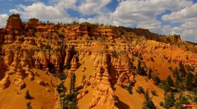
Travel & Hiking: ‘Dixie National Forest, Utah’
We spent the day hiking in beautiful Dixie National Forest which is located next to Bryce Canyon National Park. It was a pleasure to spend a day at this often unvisited location.
Dixie National Forest is a United States National Forest in Utah with headquarters in Cedar City. It occupies almost two million acres and stretches for about 170 miles across southern Utah. The largest national forest in Utah, it straddles the divide between the Great Basin and the Colorado River.
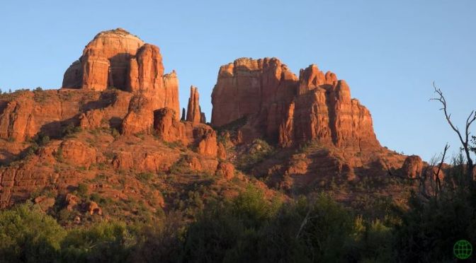
Travel: ‘Red Rock Country – Sedona, Arizona’ (Video)
The main vortexes (places of spiritual energy) and some of the most scenic locations around the Red Rock Country, Sedona, Arizona.
Sedona is an Arizona desert town near Flagstaff that’s surrounded by red-rock buttes, steep canyon walls and pine forests. It’s noted for its mild climate and vibrant arts community. Uptown Sedona is dense with New Age shops, spas and art galleries. On the town’s outskirts, numerous trailheads access Red Rock State Park, which offers bird-watching, hiking and picnicking spots.
Locations in the video: Cathedral Rock (0:32), Bell Rock (0:01, 2:27), Chapel of the Holy Cross (3:00), Airport Mesa (3:35), Sedona & Tlaquepaque (4:04), Devil’s Bridge (5:06), Fay Canyon Arch (5:47), Boynton Canyon (6:18), West Fork of Oak Creek Canyon (7:54).

Walking Tours: ‘Lake Arrowhead Village’ In Southern California
Lake Arrowhead is an unincorporated community and a census-designated place (CDP) in the San Bernardino Mountains of San Bernardino County, California, surrounded by the San Bernardino National Forest, and surrounding the Lake Arrowhead Reservoir. It is located in the Inland Empire region of Southern California, about 20–30 minutes north of San Bernardino.

Aerial Travel: ‘Santa Monica, California’ (Video)
Aerial footage of Santa Monica. Featuring: Santa Monica Pier, Santa Monica Ferris Wheel, the boardwalk, and downtown Santa Monica.
Santa Monica is a coastal city west of downtown Los Angeles. Santa Monica Beach is fringed by Palisades Park, with views over the Pacific Ocean. Santa Monica Pier is home to the Pacific Park amusement park, historic Looff Hippodrome Carousel and Santa Monica Pier Aquarium. Next to the pier is Muscle Beach, an outdoor gym established in the 1930s. In the city center, Bergamot Station houses several art galleries.
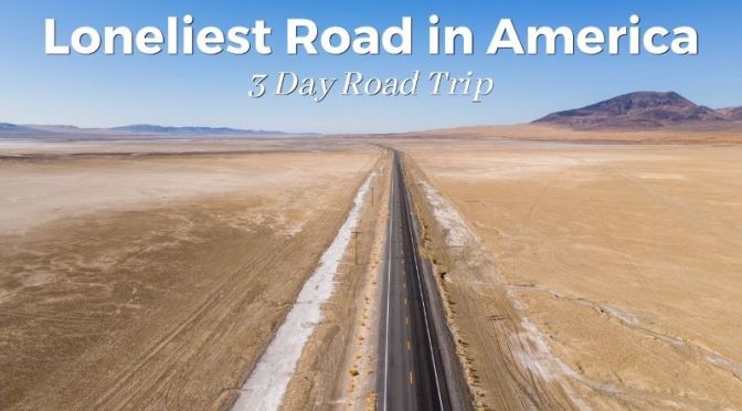
Road Trips: Three Days On Highway 50 In Nevada – ‘Loneliest Road In America’
Highway 50, through Northern Nevada, was named the loneliest road in America by Life Magazine. Since then, it has become an unofficial tourist attraction in the state and a fun road trip if you are looking to experience Nevada’s raw beauty. This drive follows the old Pony Express route and the Lincoln Highway as it traverses across the state. My dad and I set out to drive the route over 3 days, and here is our road trip that includes ghost towns, rail yards, ancient trees, and haunted hotels.
Video timeline: — 0:00 – Intro 1:16 – Day 1 – Carson City 4:05 – Day 2 – Carson City to Eureka 27:21 – Day 3 Eureka to Great Basin 46:49 – Outro
Read more at – https://www.throughmylens.com/nevada/…
Stamp Book Link – https://travelnevada.com/road-trip/lo…
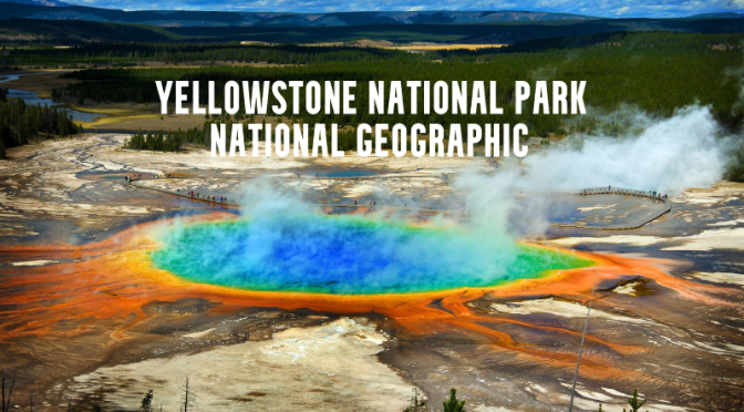
America’s National Parks: ‘Yellowstone’ – National Geographic (Video)
Few places are as special and unique as Yellowstone National Park – the world’s first national park. A wilderness jewel of vast forests and wide-open valleys, home to large bison herds, wolf packs, and grizzly bears. It sits atop one of the world’s largest super volcanoes, giving rise to such iconic geothermal features as Old Faithful geyser and the Grand Prismatic Spring.
