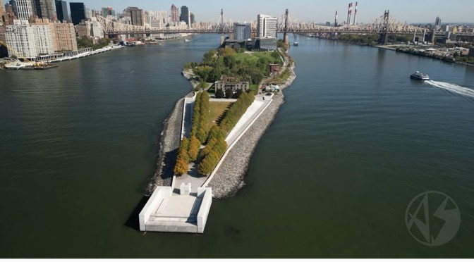
Roosevelt Island, island in the East River, between the boroughs of Manhattan and Queens, New York City. Administratively part of Manhattan, it is 1.5 miles (about 2.5 km) long and 1/8 mile wide, with an area of 139 acres (56 hectares). In 1637 the Dutch governor Wouter van Twiller bought the island from the Indians, who called it Minnahanonck. In 1828 the city acquired it and built a workhouse and penitentiary, which became notorious. Formerly known as Blackwell’s Island, it was renamed Welfare Island in 1921, and in 1973 its name was again changed to honour President Franklin D. Roosevelt. In 1934 the old institutions were replaced by city hospitals. In the 1970s the island was connected to Manhattan by an aerial tramway system, and moderate-income housing and shopping complexes were constructed there. A bridge connects the island to Queens.