

 Crossing all continents and climates (from the jungles of Costa Rica to the ice fields in Alaska’s Kenai Fjords National Parks), as well as experiences (a wine route through Switzerland or moose spotting on the Teton Crest Trail in Wyoming,) there is a trail for everyone in these pages. So pack your gear and lace your boots: this comprehensive and innovative guide will lead you to experience the best hikes of your life!
Filled with beautiful National Geographic photography, wisdom from expert hikers like Andrew Skurka, need-to-know travel information, and practical wildlife-spotting tips, this inspirational guide offers the planet’s best experiences for hikers and sightseers. From short day hikes–California’s Sierra High Route, Lake Agnes Teahouse in Alberta, Norway’s Mt. Skala–to multiday excursions like Mt. Meru in Tanzania and multi-week treks (Egypt’s Sinai Trail, Bhutan’s Snowman Trek, and the Bibbulum Track in Australia), you’ll find a hike that matches your interests and skill level.


 It’s not quite Multnomah Falls in terms of Disneyland wow factor, but it’s up there. Bear in mind that some things are justifiably popular—and Ramona Falls is just such a place. It is one of those natural wonders that must be seen in person. Photos, good as they may be, do the sprawling cascade little justice. Accordingly, the approximately 7-mile loop hike that visits it is a rite of passage for any and all Oregon hikers—including dirt-caked and determined adventurers trudging their way along the Pacific Crest Trail, which joins a portion of this route.
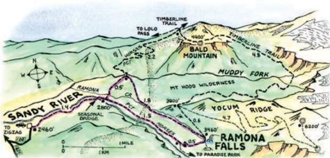

 Harpers Ferry National Historical Park (NHP) is considered one of the best walking parks in America. The views are sublime, the history compelling, the restored town a work of historical art. The variety of trails coupled with nationally significant history and the scenery of the Blue Ridge Mountains and the Potomac and Shenandoah river valleys adds up to a unique hiking experience. Harpers Ferry NHP encompasses almost 4,000 acres in West Virginia, Maryland and Virginia, and several units of the national park system intersect here. As the mid-point of the 2,178-mile Appalachian National Scenic Trail (AT), Harpers Ferry is home to the Appalachian Trail Conservancy (ATC), the headquarters for the AT. Visitors can also walk along the 184.5-mile-long towpath of Chesapeake and Ohio Canal National Historical Park by crossing the footbridge over the Potomac River. The Potomac Heritage National Scenic Trail overlays the C&O Canal and continues north all the way to Pittsburgh, Pennsylvania.
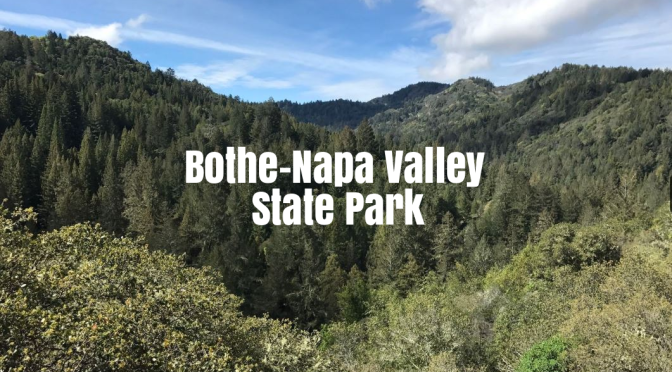
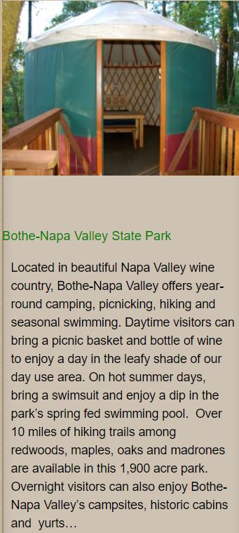 Rising on the west side of Napa Valley, the Mayacamas Mountains are best known for producing costly cabernets for wineries like Mayacamas and Mount Veeder. But they’re gorgeous, too, as this sprawling state park proves. For a beautiful, medium-challenging hike, follow the Redwood, Ritchey Canyon, South Fork and Coyote Peak trails on a 5-mile loop that leads through coast redwoods and up Coyote Peak to Instagram-worthy views. Then sit and snack on the sandwiches you got at