Tag Archives: Hiking Tour

Travel: A Tour Of Ghent In Northwestern Belgium

The Flying Dutchman (June 10, 2023) – Ghent, in the Flanders  Region, northwestern Belgium. Ghent lies at the junction of the canalized Lys and Scheldt and is the centre of an urban complex that includes Ledeberg, Gentbrugge, and Sint-Amandsberg.

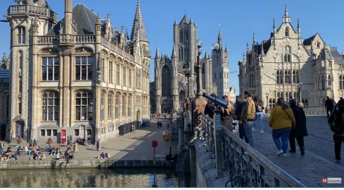
One of Belgium’s oldest cities and the historic capital of Flanders, Ghent was powerful, well-organized in its wealthy trade guilds, and virtually independent until 1584. Within its walls was signed the Pacification of Ghent (1576), an attempt to unite the Lowlands provinces against Spain. The Treaty of Ghent (December 24, 1814) marked the end of the War of 1812 between the United States and Britain.

Along with Brugge (Bruges) and Ypres, Ghent was one of the chief towns of the medieval county of Flanders. It owes its origin to the economic developments that occurred in Flanders in the 10th century, and the town sprang up on the banks of the Lys River at a spot under the protection of a nearby castle built by the counts of Flanders. Ghent grew rapidly in the 12th century, and by the 13th century it was one of the largest towns in northern Europe. Its astonishing prosperity was based on the manufacture of cloth; Ghent’s luxury cloths made from English wool were famous throughout Europe until the 15th century. 

Swiss Views: Hiking Into The Aareschlucht Gorge

The Flying Dutchman (April 30, 2023) -The Aareschlucht (Aare River Gorge, Aare Gorge) is the only way into the upper Aare valley, called Haslital. It is the original connection between the two villages Innertkirchen and Meiringen. Today there is a road across the Kirchet, the mountain ridge around the gorge, which blocks the valley. It is also called Querriegel (crossbeam), which is not a name but an old term which expresses that it runs across the valley and block it.

The Aare river is fed by rainwater and melting water from the Alps, and here it already has a decent size. The river is about 30 m wide and quite fast flowing. But the gorge is much narrower, typically about 10 m wide, and as a result the water flows faster and is quite deep. And if there is heavy rainfall in the catchment area or in spring during snowmelt the river has much more water and the level inside the gorge rises substantially.

Swiss Views: 60-Mile Hike In Interlaken-Jungfrau Area

Spent 4 days hiking 60 miles outside of Interlaken’s Jungfrau region of the Swiss Alps.

Video timeline: 00:00 Intro 07:01 Day 1 – Interlaken to Schynige Platte 11:42 Day 2 – Bachalpsee to Grindelwald 22:26 Day 3 – Eigergletscher to Lauterbrunnen 29:20 Day 4 – Murren to Interlaken 32:30 Outro

The Jungfrau Region (German: Jungfrauregion) is a region of the Bernese Oberland, at the foot of the Bernese Alps. It consists of two valleys south of Interlaken: that of Grindelwald and that of Lauterbrunnen, both drained by the Lütschine.

The Jungfrau Region is named after the highest mountain in the area: the Jungfrau. It is also notably dominated by the Eiger and Mönch. It is a major tourist destination in Switzerland and the Alps, renowned for its mountains and lakes (in particular Lake Thun and Lake Brienz). Both valleys are served by several railways: the Bernese Oberland Railway, the Wengernalp Railway and the Jungfrau Railway. The region also includes numerous cable transports and other facilities.

Hiking Tour: Ross Lake National Recreation Area In Washington State (4K)

Ross Lake National Recreation Area is a US national recreation area in north central Washington just south of the Canada–US border. It is the most accessible part of the North Cascades National Park Complex which also includes North Cascades National Park and Lake Chelan National Recreation Area.