


Tag Archives: Eastern Russia
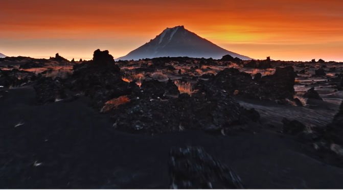
Aerial Views: Kamchatka Peninsula, Eastern Russia
Kamchatka Peninsula, also spelled Kamčatka, Russian Poluostrov Kamchatka, peninsula in far eastern Russia, lying between the Sea of Okhotsk on the west and the Pacific Ocean and Bering Sea on the east. It is about 750 miles (1,200 km) long north-south and about 300 miles (480 km) across at its widest; its area is approximately 140,000 square miles (370,000 square km).
Two mountain ranges, the Sredinny (“Central”) and Vostochny (“Eastern”), extend along the peninsula and rise to 15,584 feet (4,750 metres) in Klyuchevskaya Volcano. The trough between these mountain chains is occupied for much of its length by the Kamchatka River. Of the 127 volcanoes, 22 are still active, as are a number of geysers and hot springs. Most of the active volcanoes lie along a fault line on the eastern flank of the Vostochny Range.
The western coastlands of the Kamchatka Peninsula form a low plain crossed by many rivers and with extensive swamps, while the eastern coast is an alternation of broad gulfs and cliffed, mountainous peninsulas. A small geothermal-power station uses underground steam and is in operation near the southern end of the peninsula.
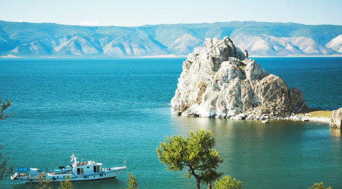
Travel Views: Lake Baikal – Siberia, Eastern Russia (4K)
Lake Baikal, Russian Ozero Baykal, also spelled Ozero Bajkal, lake located in the southern part of eastern Siberia within the republic of Buryatia and Irkutsk oblast (province) of Russia. It is the oldest existing freshwater lake on Earth (20 million–25 million years old), as well as the deepest continental body of water, having a maximum depth of 5,315 feet (1,620 metres). Its area is some 12,200 square miles (31,500 square km), with a length of 395 miles (636 km) and an average width of 30 miles (48 km). It is also the world’s largest freshwater lake by volume, containing about one-fifth of the fresh water on Earth’s surface, some 5,500 cubic miles (23,000 cubic km). Into Lake Baikal flow more than 330 rivers and streams, the largest of which include the Selenga, Barguzin, Upper (Verkhnyaya) Angara, Chikoy, and Uda.
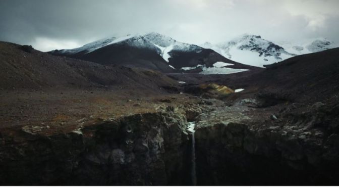
Top New Travel Videos: ‘Kamchatka, Russia’ (2020)
Filmed and Edited by: Fedor Struchev
The Kamchatka Peninsula is a 1,250-kilometre-long peninsula in the Russian Far East, with an area of about 270,000 km². The Pacific Ocean and the Sea of Okhotsk make up the peninsula’s eastern and western coastlines, respectively.
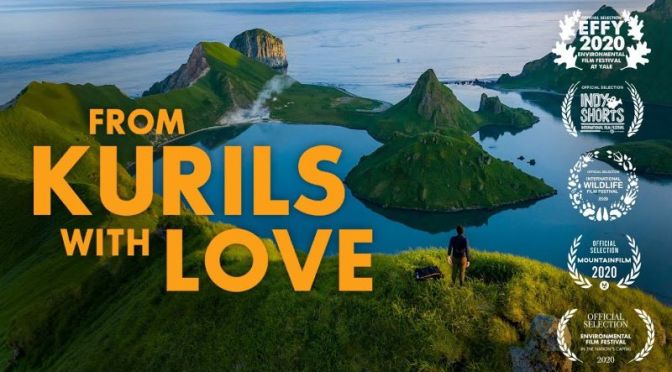
New Wildlife Films: “From Kurils With Love” – Kuril Islands In Eastern Russia
Vladimir, a scrappy Russian marine biologist, stows away aboard a boat filled with adventure junkies and a world-renowned cybersecurity expert to help fulfil his quest to understand and protect the Kuril Islands. Set in one of the most inaccessible volcanic island chains in the world, the film introduces us to a true warrior for the planet on an intimate journey of visual bliss, sea lion chaos, and ultimately a greater hope for the Earth.
Watch longer version below:
The Kuril Islands or Kurile Islands is a volcanic archipelago in Russia’s Sakhalin Oblast that stretches approximately 1,300 km northeast from Hokkaido, Japan to Kamchatka, Russia, separating the Sea of Okhotsk from the north Pacific Ocean. There are 56 islands and many minor rocks.
